Day 2 (11 Nov 2017) Saturday
I left the morning market through the same road I entered, i.e. Sathoutan Road. At the intersection with Sisavangvong Road, a breakfast stall had been set up. It was manned by two young good-looking girls. I had my breakfast there.
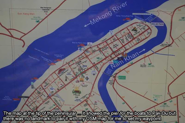
Using the OSM map where I had set the ferry ramp as my waypoint and with confirmation of the direction from the two girls, I walked towards the direction of the morning market entrance along Sathoutan Road, and continued towards the bank of Mekong River. The river bank was steep.
Nearby was what looked like an office and in front of it was a direction post. Beside it was the ferry ramp. The direction post pointed to the right/ eastwards stating that the boat pier to Tam Ting was 400m away. Tam Ting is the local name for Pak Ou Caves, more popularly known as Buddha Caves. The ferry ramp was not the place to take the boat to Pak Ou.


It was about 7:30 a.m. I walked east but did not find any office or sign of a boat pier to Pak Ou. I checked my Garmin gps unit and it indicated I had walked beyond 400m already. Maybe, it was more that 400m away. I continued walking eastwards. After what seemed like eternity, I was sure that I would have gone past the boat pier to Pak Ou. My gps unit indicated that I was already close to Wat Xieng Thong Temple, near the tip of the peninsular. What the heck! I decided to continue walking eastward, past Wat Xieng Thong Temple (as it looked like it had not open yet) and ending at a small public park at the tip of the peninsular. Where was the boat pier to Pak Ou? It was about 7:55 a.m. now. Maybe I was still too early.


After spending a few minutes taking photos at the tip of the peninsular, I told myself that the distant shown on the direction post could actually refer to the distant from the office to the ferry ramp, but that could not be 400m away! I decided to return to the ferry ramp and asked around to be sure. On the way back, I visited Wat Xieng Thong Temple after finding that it had opened to visitors.
The entrance fees to Wat Xieng Thong was KIP20,000.
As I walked down the ferry ramp to the water-edge, I saw a guide bringing a couple to a waiting boat. Two western girls who were already there spoke to the guide and then left. I stopped them to ask them about the boat to Pak Ou. They replied saying the guide told them that the boats here take passengers across the river (Mekong River), not to Pak Ou. The pier to Pak Ou was further eastwards. It was a let-down.
I followed them back to the road and continued to search for the boat pier to Pak Ou again for a while. The two girls were too fast for me. I gave up and turned back as there was no sign of the boat pier.
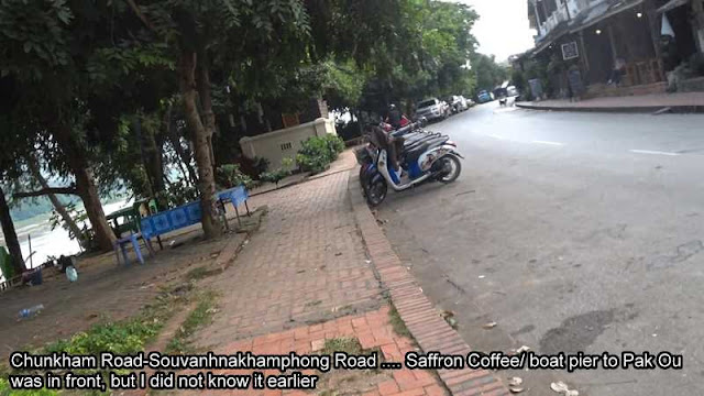
I was at the Chennai Indian Restaurant when an Indian couple pulled into the parking area in his motorcycle. I thought maybe they would be Indian Malaysian and stopped to ask them about the pier to Pak Ou. The gentleman said it was right beside Saffron Coffee. With my confidence boosted, I walked back to the east again.
Then, I saw Saffron Coffee (N19.89530° E102.13829°). The two girls were talking to someone and as they came towards me, I told them of my conversation with the Indian guy that the pier for the public boat was right there. They turned around and told me that they had found the office earlier and led me there. I asked the local girl manning the office there and she said the public boat had left at 8:30 a.m. It was slightly past 9:00 a.m. Too late! A private boat was KIP350,000 and could take 1 to 5 passengers. There were just the three of us and we have to wait if we wanted to pay the minimum amount, which would be KIP70,000 each.
The two girls said they could wait. I could wait too, so we waited. After waiting a few minutes, I began wondering how the hell would people know where to catch the public boat? There was no sign on the road. One of the touts who happened to be there advised me to come back the next day, saying there would be very, very few people already.
I thought so too and went to talk to the two girls and one of them said they have the same thought. We agreed we would not wait any longer and so we parted ways. We would meet there the next day.
It was then that I decided to explore Luang Prabang, since it was too late to go to Pak Ou Caves today.


